SA Release 2020.04.09
 At New River Kinematics (NRK), we are dedicated to the continuous development of our core metrology software package, SpatialAnalyzer® (SA). We pay close attention to our users' feedback and regularly incorporate user suggestions into new releases. In fact, you'll find that we never stop improving and enhancing SA. Read below for the latest updates, enhancements, and fixes in SA Release 2020.04.09. Click here for the download page.
SA Release 2020.04.09
Click here to view this in pdf format.
Starting 2020, SpatialAnalyzer is 64-bit application only and a 64-bit operating system is now required in order to run SA. Legacy 32-bit files (*.xit) can still be opened and saved.
Ribbon Menu Improvements
Adjusted Hide Selected Items and Delete selected items to allow rectangle select of objects.
Added a number of missing button functions (see ReadMe File for details).
Quick MP’s are now stored within the ribbon when a job is saved.
GR-Feature Inspection Enhancements
Added a readout of compensated or offset point values within the Point List for a geometry relationship. This can be helpful in checking expected raw position values.
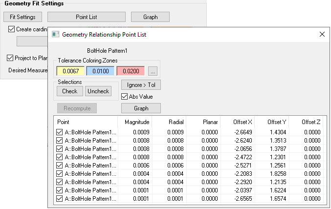
Points to Points Relationship
A new relationship type called a Points to Points Relationship has been added. This relationship functions much like a group to group relationship, comparing points with the same names, but allows user selection of a subset of nominal and actual points chosen from a selection of point groups for comparison.
GD&T Inspection Enhancements
Evaluate All Feature Checks option in the tree has be optimized and is now much faster to complete.
Added capability to set tolerance direction reference object for planar tolerance zones for true position checks.
Cloud Point Enhancements
Meshing
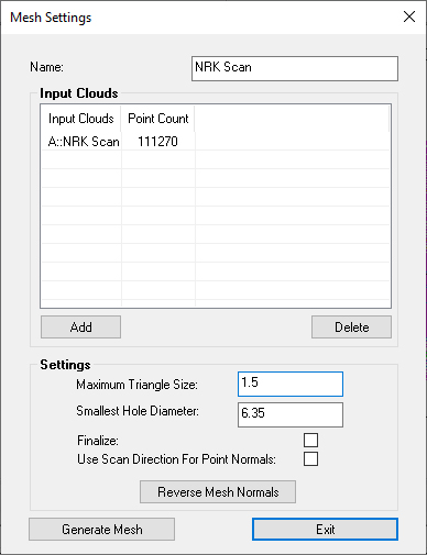
A new meshing control to SA called a Generic Mesh. This meshing option provides a number of advantages:
- It has a simplified set of meshing controls
- It accepts any combination of point clouds
- Its much faster to compute

Fit Scan Passes
Added capability to refit scan passes to each other within a cloud to facilitate cleaner mesh generation. Also a newly constructed cloud build from multiple clouds can be re-fit as well. This means that the instrument intrinsic alignment will be overridden in favor of a self-consistency within the cloud, improving meshing results.
Feature Extraction
Slots have been added to the Auto Filter to Nominal 2D Feature Extraction toolset.
RGB Color
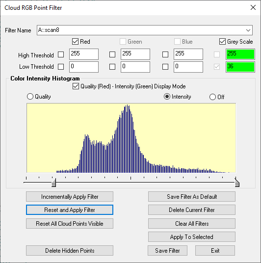
The RGB color control has been expanded and enhanced to provide a histogram display of the selected color, intensity or quality value.
Additional Analysis Functions:
New Delete by Proximity Control
Edit -> Delete Points -> Corresponding to Reference Groups by Proximity has been added to help remove duplicate points from a job file.
Expanded Edit>Move to include Instruments
Added option to select instruments for Edit >Move Objects >Frame to Frame Transform operation.
Improvements for Survey Applications
Added US Survey Feet
Added new unit type: US Survey Feet (1 US Survey foot = 1200/3937 meters or approximately 0 .3048006096m where as an International Foot is exactly 0.3048m). This unit type can be quite helpful when working with files in State Plane Coordinates.
Hidden Point Expansion
A new single-point hidden point definition or Gravity Frame definition has been added for hidden points. This new single point hidden point option will apply an offset along Z-axis of a user selected reference frame and should facilitate survey work.
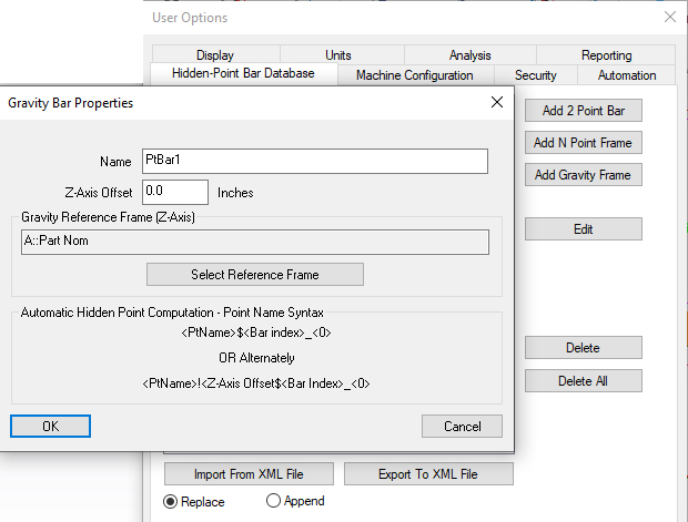
The Gravity Bar is unique in that it can be used to define a dynamic offset length
Hidden Point Bar Import/Export
The ability to import and export Hidden Point Bar definitions through the use of an XML file has also been added making it much easier to share bar definitions between computers and job files.
Obscured Point Analysis
Extended obscured point evaluation to include theodolites.
Reporting Enhancements
GR-Features
Modified relationship summary table to include tolerance information automatically when set.
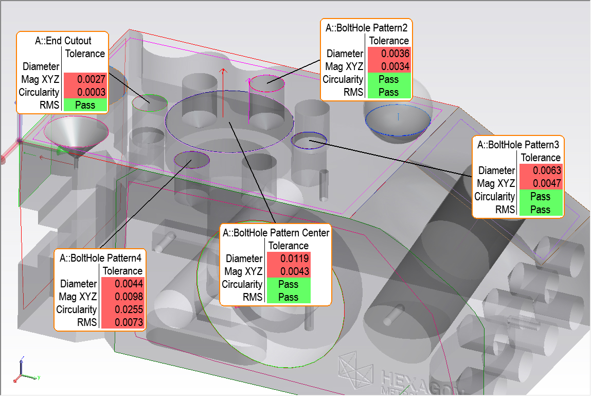
Improved initial callout placement
An improved logic is now used to place callouts logically when they are created in a view. This reduces the need to manually position them after they are created.
Instrument Developments
Added Point Sets
Added Point Set data acquisition mode. Point Sets, like point clouds, are points saved within a single entry in the tree. The advantage of a point set is that the object contains all the measurement details saved within the first point in the set and each point within a set contains a full accuracy timestamp. This provides the ability to record point location and time at high rates for long durations.

Obscured Point Evaluation
Extended obscured point evaluation to include theodolites for job pre-planning purposes.
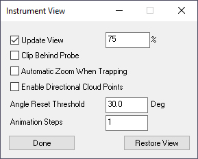
Improve Instrument View
The option to Set Viewpoint from Instrument Updates has been significantly improved. This includes better direction control relative to the measured part, more incremental control of when the view updates, and that ability to link the view zoom depth with the feature that is being measured.
Additional Instrument Startup Option
The “Connect to SpatialAnalyzer” window, accessible from the SA Instrument > Connect menu has new startup option: “New Job”. This selection ensures any coordinate parameters (e.g. drift pts) that are stored in the instrument frame are deleted, the way “New Station” does. But this one also deletes coordinate parameters that are stored in the SA World frame, such as Scan Regions/Perimeters/Points.
Leica Trackers
- Added Shutdown Tracker button to the Leica AT9x0 and ATS600 trackers.
- Added option to perform a stationary measurement at the end of each SVI position search for the ATS600.
- Added Graphic Update speed control and improved performance with AT960 and T-probe.
Faro Trackers
Updated SDK support to version 5.1.7.3. This includes a new tracker connection option using the tracker’s serial number to connect instead of the IP address.
API Trackers
Added support for the vProbe2.
CAD Import
Updated CAD import libraries including support for Solidworks 2020.
Scripting Enhancements
- String Comparison now has a case sensitive option
- New Operational Checks added for trackers.
- Sort Vectors. This command offers an adaptive sort function for a vector with a selection of sort criteria.
- Import STL File. Provides a means to import STL files from MP.
- Enable/Disable Point Set Scan Mode. Allows a selected instrument to be set to record data in a point set.
- Construct B-Spline From Point Set. Provides a means to build a b-spline directly from a Point Set.
- Set Geometry Relationship Fit Profile. Allows the fit profile of an existing relationship to be re-defined.
- Make Points to Points Relationship. Builds a Points to Points relationship assigning the corresponding point ref lists.
- Get Point List to Point List Relationship Associated Data. Returns the associated Point lists for the relationship.
- Set Point List to Point List Relationship Associated Data. Defines the associated points in the relationship.
- Generate Geometry Relationship Summary. This new command provides the ability to build GR summary table from MP using a relationship list.
- Delete Measurement Observation. This command allows specific observations to be removed from existing points.
- Move Measurement Observation. This command provides a means to move an observation from one point to another.
- Get Number of Points In Point Set. Returns the number of points recorded within a Point Set.
- Get Timestamp for i-th Point in Point Set. Returns the timestamp from the selected point.
- Get Coordinate for i-th Point in Point Set. Returns the working point coordinate from the selected point.
- Export ASCII Point Set. Exports the selected Point Set to an ascii file
- Construct Surface From a Collection of Surfaces.
- Auto-Measure Surface Vector Intersections. This function provides a measure to trigger Surface Intersection (SVI) measurements from supported instruments (Laser Radar and ATS600 currently).
Added a series of basic math operations that use a common “Accumulator” variable to help clarify math operations.
- Accumulator Clear.
- Accumulator Add.
- Accumulator Subtract.
- Accumulator Multiply.
- Accumulator Divide.
- Accumulator Power.
- Accumulator Invert.
- Accumulator Change Sign.
SA SDK
Added C++ SDK VS2019 client’s side example.